I’m cycling in raising funds for childhood cancer research.
The Ben Towne Center for Childhood Cancer Research is currently conducting three FDA approved cellular immunotherapy clinical trials using reprogrammed T cells. Hear from the doctors conducting the research and working with patients as they tell the story of progress in this video:
Did you hear that? Just nine days after treatment and a patient was in remission!
Thank you so much to those who have donated and brought us to 5% of the $20,000 goal. With everyone’s help, I know we can still make this goal.
I realize you might think, ‘Well, you set that goal for us, that’s kind of unfair.’
What’s unfair: childhood cancer.
We have an incredible opportunity to change what is unfair. With continued support to accelerate research, children receive a new outcome: Life. Less treatment. Less impact from long-term side effects.
As it is now that we can accelerate the progress in changing the future, I ask you to not wait until you know someone effected. By donating today, you can make that 5% rise, and change the outcome of childhood cancer! Simply start by clicking on the logo below.

Monday, May 25, 2015
I wake at 9:00am. I’m sore. My calves are sore going down the stairs and I can barely walk straight. My arms are sore, my abs are sore, just about everything is sore. I have never been all-body sore from cycling, until now. And I know it isn't just from yesterday but is an accumulation of the last six days and here’s one more. I made it to today: I can make it to tomorrow.
After breakfast, I clean the chain on my bike while it is still in the cloakroom. Which I think is just great, I’m in the cloakroom! But don’t worry, no one actually stores their cloaks in here anymore, it has clearly become a storage room.
l leave heading south at 11:26am, which I realize is an extremely slow start, but I’m tired here. A couple miles out of town and I am on National Cycling Route 775. At first it is on a dedicated cycling and walking trail and then transitions onto minor roads. I have never done any combination of cycling, hiking, or anything else for seven days in a row, so this is something.
I reach Bridge of Earn just 4.0 miles (6.4 km) after leaving Perth, having cycled a pace of 10.43 mph (16.79 km/h).
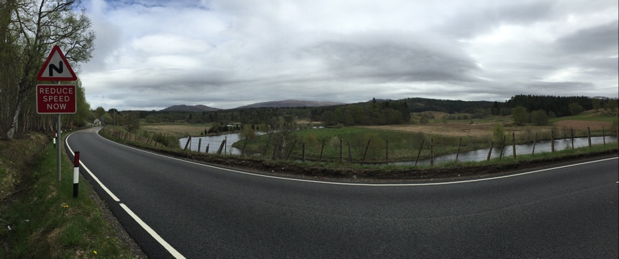
After leaving Bridge of Earn, I meet a hill that is the most challenging yet. This is a combination of my muscles being tired and it being really steep! I keep at it, slow revolution by revolution of the pedals and I make it without stopping. I love you, hill! Soon after, a couple of rabbits cross the road.
Glenfarg comes next, 6.3 miles (10.3 km) later, having cycled a pace of 7.84 mph (12.61 km/h) with that lovely hill included.
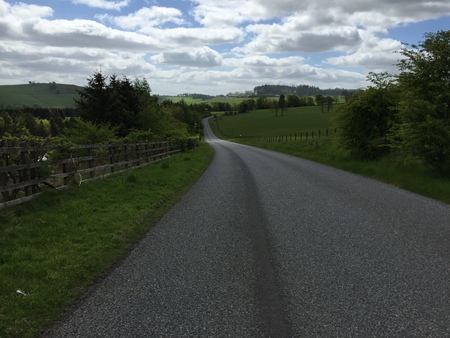
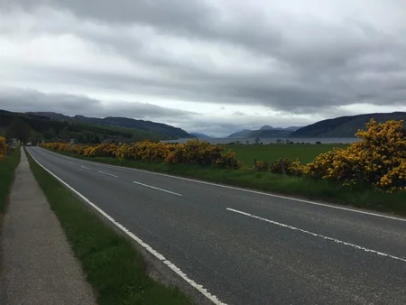
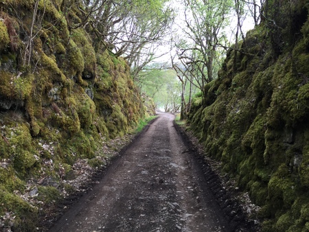
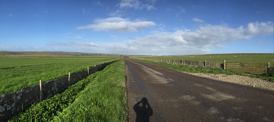
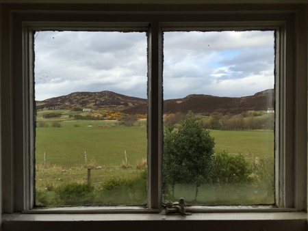
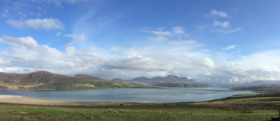
The cycling route on the way to Glenfarg.
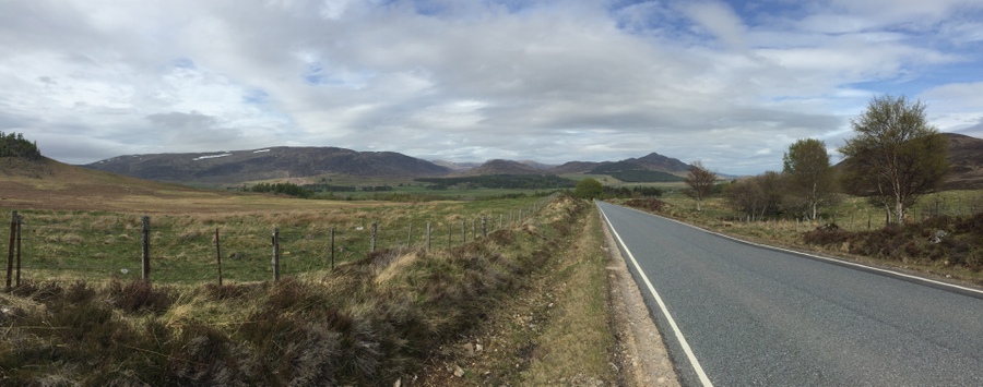
Ahead there are two deer in a field. As I slow down to take a photo, they run. Plenty of wildlife today. I arrive into Kinross at 1:30pm, having cycled 7.3 miles (11.7 km) at a pace of 12.88 mph (20.73 km/h) since leaving Glenfarg.
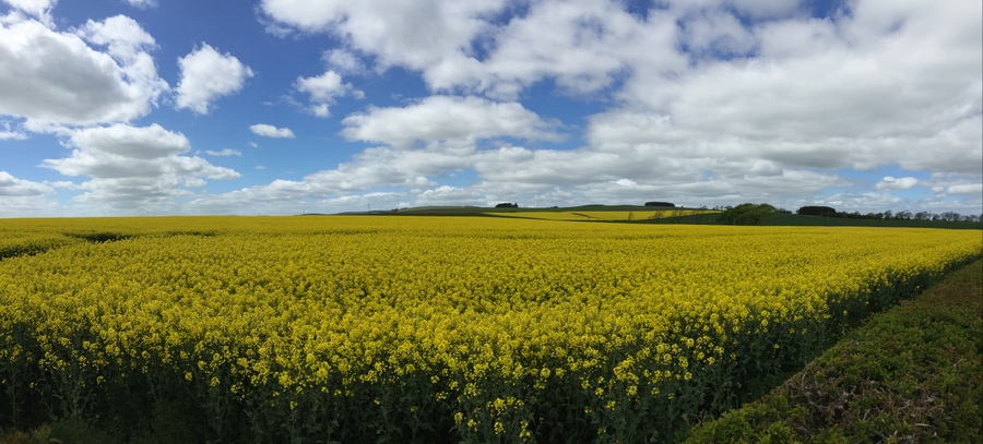
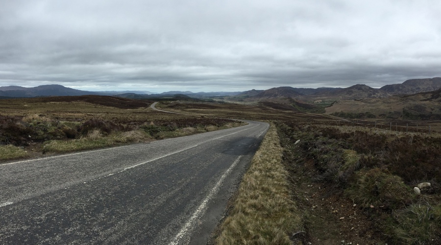
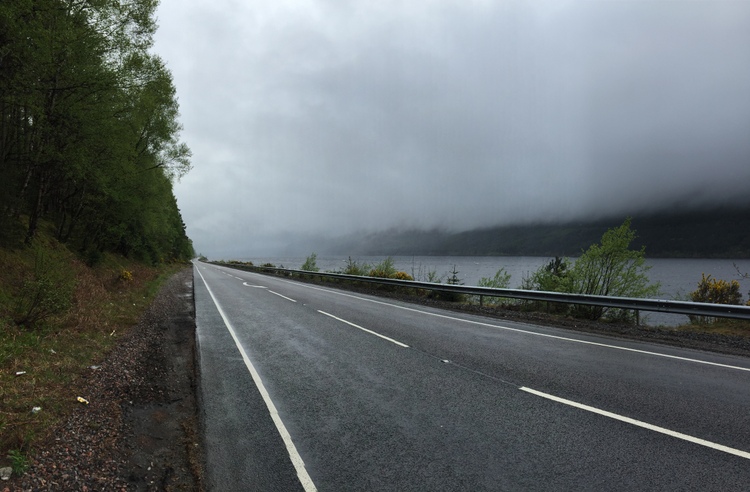
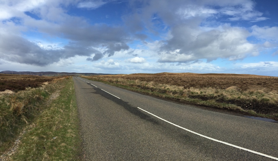
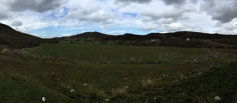
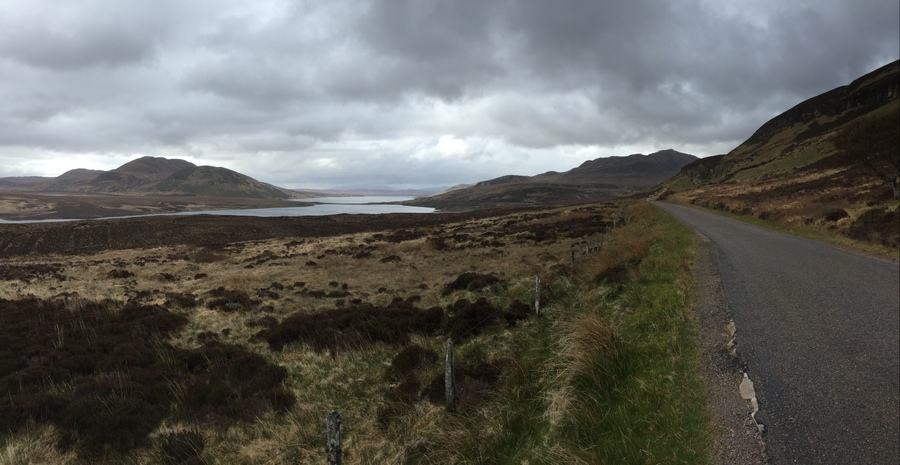
The cycling route between Glenfarg and Kinross.
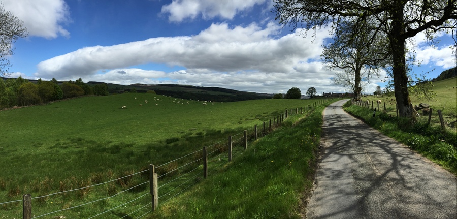
There are horses in the pastures along the road. Soon my route transitions onto National Cycling Route 1: the 'Kingdom Cycling Route.'
There have been a lot of hills recently. And now that means going down, which makes it totally worth it. I am going down a really steep hill in the realms of 35 mph (56 km/h) when it turns sharply, forcing me to majorly slow down, which was quite the disappointment when having all that speed!
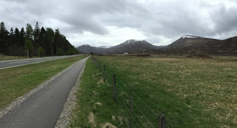
I arrive into Townhill at 3:07pm, 11.5 miles (18.5 km) after leaving Kinross, having cycled a pace of 9.32 mph (15.01 km/h). I honestly can’t believe how well my pace is today, which is dang exciting when I did not leave early and need good riding.
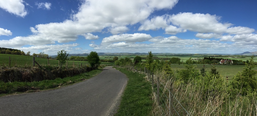
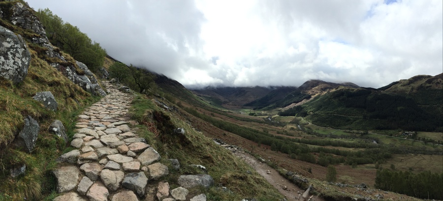
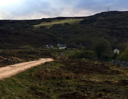
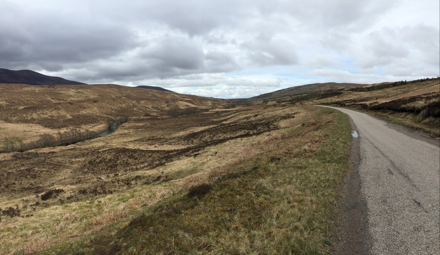
The cycling route between Kinross and Townhill.
After Townhill, I arrive into Inverkeithing 5.7 miles (9.2 km) later, having cycled a pace of 10.36 mph (16.68 km/h). It’s 3:40pm and I am hungry. I’m making such good time that I feel I probably have earned fish n chips along with a raspberry milkshake. Either way, that is what I have.
After a one-hour break for lunch, I am back on my way. I continue on the road for a short distance and the route is now on a dedicated trail. This then crosses the Forth Road Bridge over the Firth of Forth, the area where the River Forth empties into the North Sea. (Firth means estuary.) There is a train bridge to the east and piers being built for a new bridge to the west. I really like bridges, so this is grand.
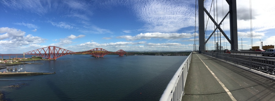
Crossing south over the Forth Road Bridge with the train bridge to the east.
Today I feel like I now know my bike. I know what pedaling in each different gear feels like and how it is going to shift, brake, and turn. You don’t know that on day one, and it apparently takes 500 miles (805 km) to be able to say that I now know this bike. But does it know me?
Once across the bridge, the route continues on roads and feels like the area of the Lake Washington Loop between Montlake and I-90. It then joins dedicated trails in the city like the Burke Gilman. I eventually leave the trail and join rush hour traffic on the city streets. I go down the streets that are only for buses, taxis, and cyclists. There, me, between double-decker buses. After about two miles I arrive at the hostel where I will be staying for the night. Welcome to the Capital of Scotland: Edinburgh!
Since leaving from my fish n chips, I cycled 15.7 miles (25.3 km) at a pace of 9.61 mph (15.47 km/h). It is 6:19pm, well before I thought I would arrive. My muscles are spent. Spent.
Today was such a beautiful day. It was so sunny with nearly no wind and I didn't have a single clothing change. I should have used sunscreen. I have a well-defined line at my arms and my face shows it. My back has a fresh red stripe across it where, while leaned forward and riding, my shirt did not overlap with my shorts: that's an interesting one.
For a big city, I would generally try to book a private room through AirBNB, but sometimes the budget says you go with the hostel. And this one is actually really nice, the nicest I have stayed in. The bathrooms and showers are actually in each room, not down the hall. And instead of 8, 10, 12 people or more in a room, there are only 6.
After taking a shower, I head to a nearby bar for dinner and some drinks.
Photo Gallery – Perth to Edinburgh: Cycling Day 14
Daily cycling stats:
Distance: 50.6 miles (81.4 km)
Moving average: 9.76 mph (15.71 km/h)
Tuesday, May 26, 2015
The walk up the stairs to breakfast wasn't lovely. After breakfast I go back to bed. I am not cycling today, definitely not cycling today.
I nap for about an hour. I don't remember the last time I was this sore everywhere at the same time. I shave, as I haven't in two days too many.
From the hostel, I travel across town on a bus to a hotel. I arrive early so go ahead to the restaurant and wait at the reserved table. Soon the members in leadership of the Clan Mackay Society arrive: the president, vice president, secretary, treasurer, administrator, and another member.
I order a Bloody Mary. It was sort of a joke at first that someone else started, but then I did. And then I end up being the only person with an alcoholic drink. I don't know how these types of meetings are supposed to work. And fair enough, they didn’t know it wasn’t something to joke about because I might be the type of person to take up such an idea.
At lunch I share about the research I have done and also learn more about the clan and the members there. And I join the society as a life member. I don’t even know what to compare this experience to!
Wednesday, May 27, 2015
After breakfast, I do laundry. For my whole length of travels I am travelling with five sets of the basics: boxers and t-shirts. And for my cycling I have dropped to just fours sets. That means doing laundry every three days, while you are in the last clean set. Once you are used to planning around it, it just becomes the way of your life.
I spend most of the day at a bar, because they have fast Wi-Fi and I like the atmosphere.
In the evening, I take a bus across town to a coffee shop and meet with Fiona and Mary. Fiona is a cousin that I met through Facebook. No joking. Through my research, I discovered a County Sutherland Research group that I joined. After I had enough research completed, I posted the details to the group and Fiona later emailed me, telling me we had common ancestors (making us cousins). She later sent me a very thorough document on the family that included my known relatives.
Mary is 83 years old and Fiona put us in touch several months back. She is basically an expert on the area my family left from, in Tongue where I visited. She is connected with the Mackay’s through her late husband. Mary is 83. It is so cool to me that over the past months I have been emailing with them and that a woman that is 83 and not related to me has been helping me out on my research and now we are meeting for coffee!
Thursday, May 28, 2015
I start off the day heading to Edinburgh Castle. The lines are already very long, and it is $25 for entry! And I’ve seen several castles before. If I had never seen a castle and knew I would never have a chance to see one again, then fine, I might pay that much, but dang!
Here’s the thing, when I travel I think in pints (of beer). For example, if I come under budget on my accommodation for the night, that frees up funds for food, or more importantly, for pints. Staying at a hostel rather than a hotel really makes funds for pints. Seeing the inside of Edinburgh Castle is worth four pints. Would I rather have four pints in a pub or see the castle? I didn’t see the castle.
I walk down the Royal Mile, as the road is known, to St. Giles' Cathedral. There is a choir singing inside so it happens to be a very nice time to have happened to come. From there I go to the Museum on the Mound, which covers the history of the Bank of Scotland. There is printing plates, old iron chests (safes of their day), and lots of money. In fact, they have a block of one million pounds sterling (about $1,600,000).
My time in the Scottish National Gallery is fairly quick, enough time so that my eyes pass over every piece of art. To be honest, most art doesn’t impress me, especially really old art. Every once in a while, I am impressed, one reason why I give it a chance. However, one reason I like galleries and museums, even if I don’t happen to love them, is that they give me ideas. I see new things and they make me think.
For lunch, I go to a small café. I have a Caesar salad with chicken and a cappuccino and am down $20. This place is not fancy and I can’t believe that cost what it did. That could have been pints.
I go to the cinema (movie theater) and watch Avengers. That might be a surprise, that I would go and see a move while in such an amazing city. But it's not like I'll be in a 'crappy' city that would make better sense to do it. I don’t watch a lot of films (movies) at home so now would be the time to do it!
In the evening I meet up with Kalle at a pub. Kalle’s mom is Margaret, the woman who works at the museum in Bettyhill that I visited and took me to the location of the battle of 1433. When you travel you meet lots of new people!
Friday, May 29, 2015
I start the day at the National Scottish Museum, which covers history from the beginning of man. I spent four hours there: I like that museum.
Along the Royal Mile there is a street performer. He does some knife juggling, hammers a nail into his nose, swallows a sword, swallows fire, and has a member of the crowd stand on top of a board with nails going to the performer’s stomach while he lays on his back. Well, the performer chose too large of an assistant and some of those nails actually go into his skin and he has to pull the board away until the tips of the nails come out!
I next spend quite a bit of time on Calton Hill where there are great views in all directions. On the hill is a National Monument and also the Lord Nelson Monument and Maritime Museum.
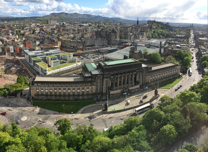
Looking towards Edinburgh Castle from the top of the Lord Nelson Monument.
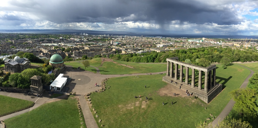
Looking down on Calton Hill and beyond from the top of the Lord Nelson Monument.
From there I go to the Old Calton Burial Ground. There is a Scottish American War Memorial with a statue of Abraham Lincoln.
In preparation for tomorrow, I clean and lubricate my chain. I intentionally do this before heading to a pub for dinner, to ensure that I actually did it today!
Since I only have a few days worth of clothing, and I want clean clothes to change into tomorrow night, I do another small load of laundry.
I feel like I didn't actually see a huge amount here but it was an awesome time just enjoying the atmosphere of the city and I had rest that I needed. I also took a rest from taking so many photos.
Saturday, May 30, 2015
I'm cycling today. But right now I don't feel like I want to, even though I know I do. I know once I'm on that bike, that this day will be mine.
For breakfast I have some cold meats and cheeses (typical here), peach and passion fruit yogurt, a large roll with raspberry jam and strawberry jam, a glass of orange juice, a glass of apple juice, a strawberry yogurt, and a coffee.
A girl comes up to me just after I've finished breakfast and asks if I'm from Washington. Yes. She has spotted my purple and gold cycling jersey. She grew up in Snohomish and went to Seattle Pacific University and just finished a one-year program here.
I leave on my bike at 9:16am. After correcting my route after a wrong turn, I am on National Cycling Route 1. After 8.6 miles (13.8 km) at a pace of 9.05 mph (14.57 km/h) I arrive in Dalmeny.
Sandra and John, who I met at the lunch with the Clan Mackay Society, are here at the Norman Church for a bake sale type of event, with other items for sale too. The Norman Church was built starting in 1130.
Upon leaving, I become extremely confused with the route and what turn I need to make. What I ‘know’ is my route from having planed it, does not agree with the National Cycling Route sign indicating to go in a different direction. I literally don’t know what to do so take five minutes trying to figure it out before deciding not to follow the signs.
I end up on the right route, not what the signs indicated, after another five-minute delay from missing where the trail left the road and into the woods, on a narrow dirt path.
The narrow dirt path leads to a trail that becomes dirt and gravel, which is National Cycling Route 754. This gravel is not what I was asking for. I am on a road bike with no suspension and smooth, skinny tires. The only suspension comes from my butt, and I don’t care for it at all. The route puts me along the Union Canal and then I am cycling directly into winds of 15-20 mph (24-32 km/h).
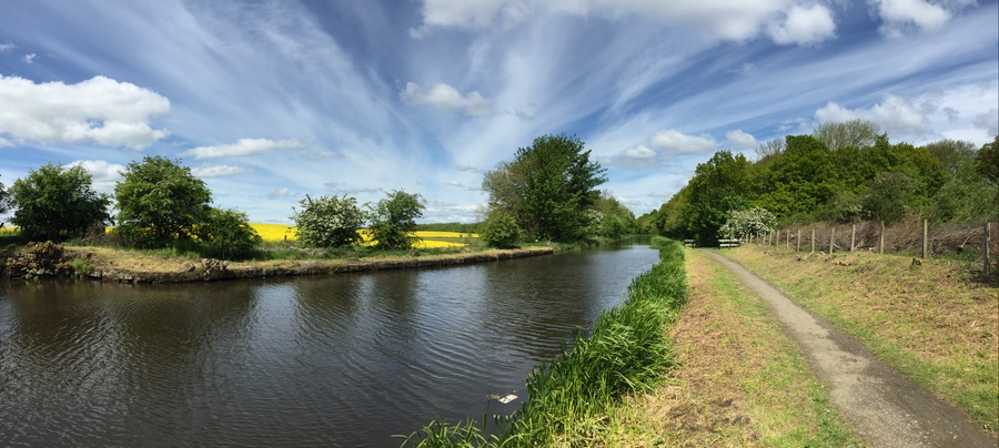
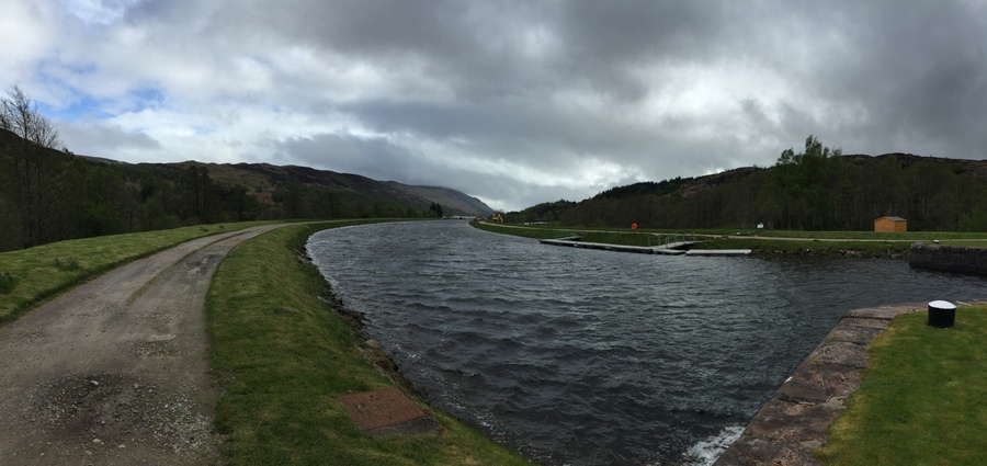
Cycling route along the Union Canal.
There are many bridges that cross over the canal. Because of the bridges, the trail goes around the foundations rather than staying straight. This moves me closer to the canal, literally less than two feet away from the water’s edge. This also creates the equivalent of a blind turn, as you can’t see to the other side of the bridge and whether someone else is coming. With there being no space for more than one person or bicycle to pass this short section, it is quite scary, along with the water right there to dump off into. There is no real option other than coming to nearly a stop and unclipping my shoes to go around the bridge foundations. And there is bridge after bridge after bridge, so lots of slowing from a cruising speed and then needing to start up again.

The trail offsets closer to the canal at every bridge.
More than one person had commented about how the canal cycling route would be so fast, because it was flat, being right along the canal. Level is what they meant. But level is not flat, and they didn't consider a road bike. Besides slowing for all the bridges, the path is primarily large, semi-sharp gravel. I am so not happy about this and pretty much know it is going to be a miracle if a tire doesn’t have a puncture. Despite the roughness and risk of a puncture, I still have to go as fast as I can because I don’t have hardly any extra time in my schedule to go slow, or stop because of a puncture. I don’t like this pace on this terrain at all. The suspension my bike has: zero. My arms and butt are handling all the turbulence.
And then I hear hissing. It is air. And I start braking. It is the rear tire. It is 12:21pm.
I stop to replace the tube. I have to remove the panniers and water bottles and flip the bike upside down. I find one of the two spare tubes in a pannier and go to work. I unfortunately struggled a bit with the tube sitting right in the tire, but eventually had it all back together. The puncture equaled an 18-minute delay.
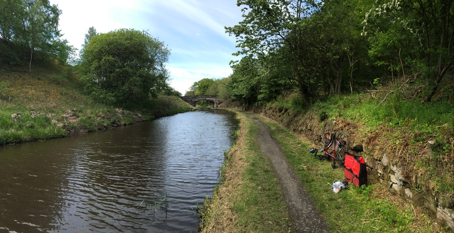
Where there was an unintended stop to change a flat tire.
I should have been able to change the tire faster. But of course some of those 18 minutes were used to take photos. My hands are filthy. I have wet wipes somewhere, but there is no time to find them. I quickly wipe my hands on the grass but it isn't much good. I right my bike, put water bottles back on. Roll panniers shut and the grease transfers from my hands to the bags. There is still plenty on my hands from having to grab the chain to remove it and put it back on the rear wheel. I believe it is a sin against your bike to ride it with greasy hands. It is all over the handlebars and gear shifters!
I know our rule, but we don't have time. Sorry muscles, you're going to have to burn. I don't have time for another puncture: I'd have to change it in the time of the gods.
The gravel transitions to a finer gravel that I really speed up on. I end up on some paved areas and then the route transitions back to rough gravel, then dirt, and then finer gravel. And all of this is riding straight into the winds.
The canal, and my cycling route, come to an aqueduct that carries us across a valley and over the River Avon. It is amazing. The canal is flowing across the valley up in the air, above a natural river. I have never seen something like this in person and this is my route! The path becomes large cobblestone, a very unsmooth ride. I dismount and walk, which also was not fun in my cycling shoes on all the rocks. I wouldn’t ride this on a road bike even if it were allowed. The width of the path puts me so close to the water. It wouldn’t take much of a bump on this cobblestone to have me falling in. Imagine that, my bike and I in the canal, up in the air across the valley in the Avon Aqueduct. No thanks.
There are some other people that come across the aqueduct in the opposite direction, so I move to the side and stop for them to pass, as my handlebars take up nearly the width of the path. And of course I have to take some photos, slowing me down further.
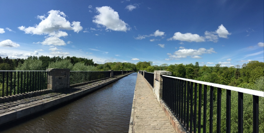
Crossing the Avon Aqueduct.
My schedule for the day did not account for walking. No one told me about these delays! This route is beautiful, but not for a road bike and not for going fast. I am stressed out about time but walking my bike across this canal is definitely a highlight.
I come upon some swans and their babies, right by the trail. And you know I had to stop and take some photos.
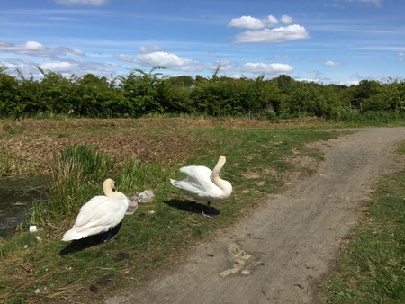
Swans and their swan babies.
Not long after leaving the aqueduct, there is a junction in the trail for access to it and directional signs. I have 8.5 miles (13.7 km) more to go and 44 minutes to do it. I need to average 12.0 mph (19.3 km/h).
The burn is on. On the worst terrain I have cycled yet, I turn it up. I hit 14, 15, and 16s and even break 17 mph (27 km/h). Then I’m into the wind and drop to 11 mph (17 km/h). This won't be fast enough with all the stops. Sorry muscles! I shift up a gear. (Today, for the first day, I’m using my phone in a handlebar mount to be able to know my progress in real time.)
I can’t believe this. I come to a tunnel and am forced to dismount and walk. There are people walking through from the other side. Once they pass, I decide to cycle through. I have to.
Once I’m out of the tunnel, it is not far before there are gates that I have to dismount and walk through, the type that offset left and then right. This is incredibly frustrating! The day my pace can’t afford this is the day the route provides it. I accept that I’m going to be late. But I keep riding hard. And continue to stop to walk around a total of five gates. Absolutely the worst design for a gate on a cycling trail, it not only slows a cyclist down but a cyclist can’t even stay on their bike to go through. And the wind isn’t helping out either.
I cross over a section of extremely large cobblestones at full speed. That was a mistake. My phone is gone! It has been on my handlebar mount. (expletive) I go back and find it to the side in the grass, not far after the section of cobblestone. Unharmed. So relieved.
I come upon another tunnel. The path is wider, there is a railing between me and the water, and the path is flat concrete. I zoom through at full speed and then down a steep walking path.
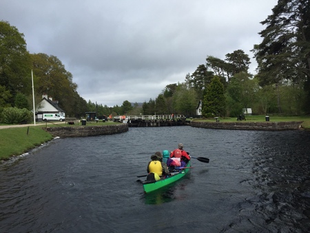
Minutes later, I arrive at 2:08pm, with just two minutes to spare. I say to a staff member that I have a 2:10pm booking and ask if it is too late. She says it isn’t. I ask if it is okay to lock my bike to the fence right there. She says it is and asks if I have a ticket. I tell her just on my phone. She asks for my name and runs into the building and comes back with my ticket just as I finish locking up my bike. I walk onto the boat at 2:10pm, sit down in the only remaining seat, and the safety talk starts seconds later. Welcome to the Falkirk Wheel!

The Falkirk Wheel in action.
The Falkirk Wheel is the first and only rotating boat lift in the world. Like me, you probably have never heard of such a machine! I like bridges, I like canals crossing above valleys in aqueducts, and I am sure going to like this. Rather than traditional locks, the rotating lift is used to raise and lower boats, connecting the Forth and Clyde Canal with the Union Canal (the one I have been cycling along.) It was completed in 2002, reconnecting the canals since they last were in the 1930s. To go between canals, it used to require passing through a flight of 11 locks and take most of a day. Now it takes 4.5 minutes.
The wheel has two caissons that hold the boats. When in loading position, there are watertight doors that lower to allow the boats to enter. The doors then rise back up and pumps change the water level as needed to ensure both caissons are the same weight. Then the Celtic-inspired double-headed axe shaped machine rotates. With being perfectly balanced, it takes very little energy to rotate, the same amount as boiling eight teakettles of water. As the wheel rotates, the caissons rotate as well, so they remain level. Minutes later, the two sets of boats have been raised and lowered 79 feet (24 meters), the wheel itself overall being 115 feet (35 meters).
The boat I boarded was for tours and started at the lower level, at the bottom of the steep walking path. Once at the higher level, it goes across the aqueduct that connects it to the higher elevation of land where the Union Canal runs through the last tunnel I had cycled through. The boat then turns around and we come back and down again. The views are incredible and it was so cool.

Heading back to the Falkirk Wheel in the aqueduct from the Union Canal.
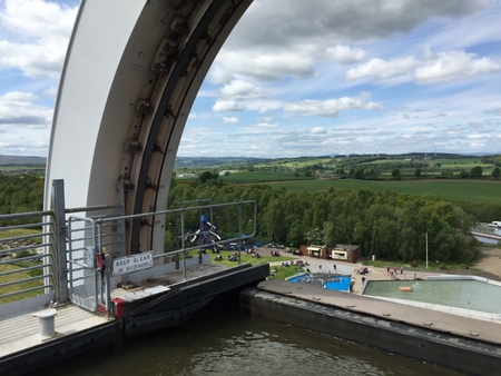
Looking out over the end of the caisson before the wheel lowers us back down.
After departing the boat, I was no longer stressed like I had been cycling here. Feeling loads better. I eat lunch and then walk around the wheel in amazement of it. I wish I could have designed something so brilliant. Coming from Dalmeny to the Falkirkwheel was 22.0 miles (35.4 km) that I rode at a pace of 9.64 mph (15.51 km/h), which feels remarkable considering the wind, stops, walking, and terrain. By far, it is the worst distance of terrain I have cycled so far.
Before starting off again, I clean my chain. I just cleaned it last night. I never imagined I would be cleaning my chain midday. It makes me sick to see how bad it is! My chain looks like a stable that is past due for a cleaning. There is literally fibrous material from straw and grass compacted into the chain and gears.
I review the rest of my route, and yep, it now will be along the Forth and Clyde Canal nearly the rest of the way. The scenery is beautiful, but the trail conditions for my bike are horrendous.
The game plan for the rest of the day is high cadence, no burn. It has been reinstated, no matter how long the rest of the day takes. It is nearly 5:00pm when I head off. The trail is initially fine gravel, which I prefer second to pavement. There are 10-15 mph (16-24 km/h) winds, but hey, at least it is sunny!
There is a huge swan sitting on her nest on the other side of the canal as I ride along. And there is also an enormous bird similar to a stork, but it would be the largest stork I have ever seen, and it looks nothing like a swan. After that wildlife spotting, the trail changes to course gravel and dirt. There is another one of those gates I have to dismount and walk through. For being a National Cycling Route, it is hard to understand that design!
The winds come and go, being 5-10 mph (8-16 km/h) when they come. There is a stretch of canal with so many lilypads and there are quite a few pairs of swans in the canal as I go along. There are also more locks that I pass.
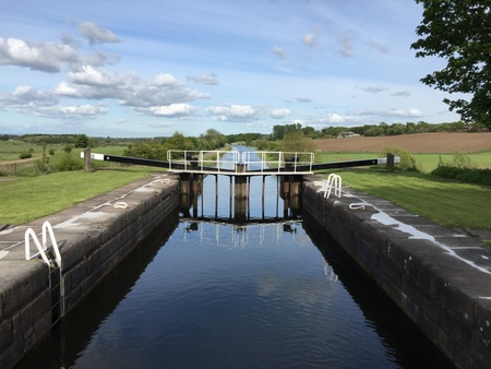
A lock on the Forth and Clyde Canal.
Most of the locks are operated by the people on the boats going through them, not by any permanent staff for the lock. The boat arrives at the lock, a person or two come ashore, and open and close the gates as needed for the water to fill up or lower down as needed for the direction they are going. All the gates are manpowered, no motors or controls. Once the boat is on the other side, the people re-board the boat and go on their way.
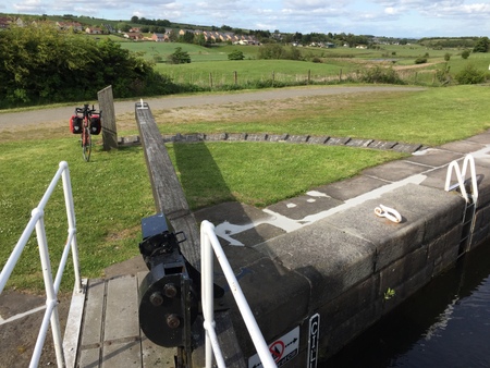
The self-operated mechanism to open the lock gates.
After leaving the Falkirk Wheel, I pass through Kelvinhead 6.9 miles (11.1 km) later, having cycled a pace of 7.67 mph (12.34 km/h).
My route comes onto the John Muir Way trail, which is also National Cycling Route 754. As I continue on, there are sections with puncture-worthy rocks and then dirt with small sections of mud. From Kelvinhead, I cycle 8.0 miles (12.9 km) to Kirkintilloch at a pace of 9.06 mph (14.58 km/h).

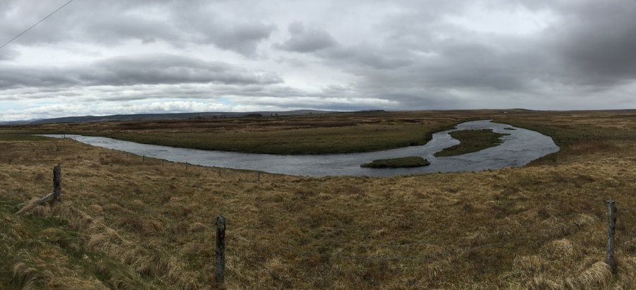
The cycling route between Kelvinhead and Kirkintilloch.
The route brings some pavement and I pick up the pace. At 7:40pm, I enter the city traffic and the rain starts sprinkling. Reaching 12.6 miles (20.3 km) beyond Kirkintilloch at a pace of 10.8 mph (17.38 km/h) puts me to my accommodation for the night that I booked through AirBNB. My host is not home but has left the keys at the café on the street level of the building next door. I come out with the keys and the rain has picked up a little, I’m glad I’m done for the day. Welcome to Glasgow!
I carry my bags and then my bike up three flights of stairs to the flat I am staying in. I shower and then head back to the café for dinner. I have chicken stew, a side of olives, and one cider. I can barely stay awake.
Photo Gallery – Edinburgh to Glasgow: Cycling Day 15
Daily cycling stats:
Distance: 58.1 miles (93.5 km)
Moving average: 9.40 mph (15.12 km/h)
Accumulative cycling stats:
Distance: 591.4 miles (947.1 km)
Moving average: 8.31 mph (13.31 km/h)
I'm not scared to finish this ride. And I don't want you to be scared to get good and ready to support this cause. You can even do that right now by clicking on the logo below.

Map of cycling in the lowlands:

"Do what you can, with what you have, where you are." – Theodore Roosevelt
Author, explorer, soldier, 26th President of the United States of America. October 27, 1858 – January 6, 1919