Sorry for the delay folks! I’ve been traveling at a quick pace without time to produce a new post. Also at this time, the posts are going to become more abbreviated due to me not having the time to continue including the same level of detail as the posts have had to date. But don’t you worry, you’ll still have many photos!
Wednesday, June 3, 2015
This day continued from last post.
My task is complete, but my day is not done. I’m not going to spend the night on the border of Scotland and England.
I continue cycling south into England and at 7:49pm arrive to my friend Steve’s home in Carlisle. I know Steve from my first trip to Ireland in 2005. He is now married to Claire.
Thursday, June 4, 2015
After all that cycling, I slept in until noon. Then the rest of the day was basically a rest day.
Friday, June 5, 2015
In the evening, Steve, Claire, and I head of out town, stopping for dinner at a pub on the way, and then arrive for the night at a bed and breakfast near Lake District National Park.
Saturday, June 6, 2015
At 8:00am we have breakfast and then head out. As we drive on the country roads, we encounter some cows that we have to go around.
We park at our destination and are on the trail at 10:45am. As we start our hike, there are already winds of 20-25 mph (32-40 km/h) with gusts of 30 mph (48 km/h). This is Steve and Claire’s first significant hike, what they like to call ‘hill walking’ around here.
The trail begins through a pasture. We're going generally uphill in the wind and then come into a valley that shelters us and there is nearly no wind. About half way up the valley we begin to enter the clouds.
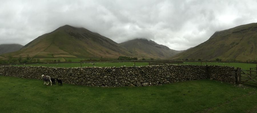
The trail begins through these pastures.

We pass amongst some cows.
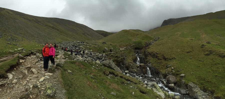
Up through the valley we go.
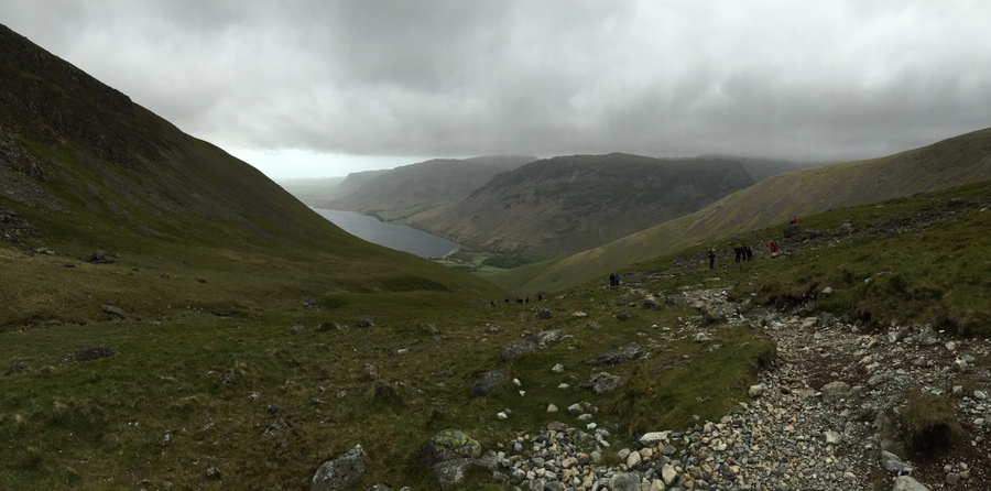
Looking back on the trail.
About three-fourths of the way up the valley we take a right where the trail splits to take what is supposed to be a more scenic route and slightly more challenging. We have started on the easiest route and are making good time. Now if we had thought about it, a more scenic route in the clouds didn't make a lot of sense. At the top of the valley it becomes steeper and the trail turns to dirt mixed with gravel, which wouldn't have been our first choice. At the end of that terrain it becomes steeper and primarily rock, which requires us to climb with our hands. I didn't personally mind but I knew that with Steve and Claire being first time hill walkers that they did.
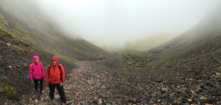
Passing through steep, rocky terrain and coming into the clouds.
After we make it through the segment of rock, we arrive upon a ridge and are in the wind again, now 25-30 mph (40-48 km/h) winds. With the clouds limiting the distance we can see, it takes a little bit of route finding work. The terrain is also a bit different than anything I had ever seen before, rocks surrounded by moss as far as we can see.

Just a bit of an unwelcome scramble for my hill walking companions.
Rocks and moss on more gradual terrain.
Since it is quite gradual at this point, there isn't a defined trail because people have obviously just spread out and a common path has never been defined, so that didn’t help with the route finding. There are areas where you can see that the rocks have been walked over repeatedly, and the lichen is worn away.
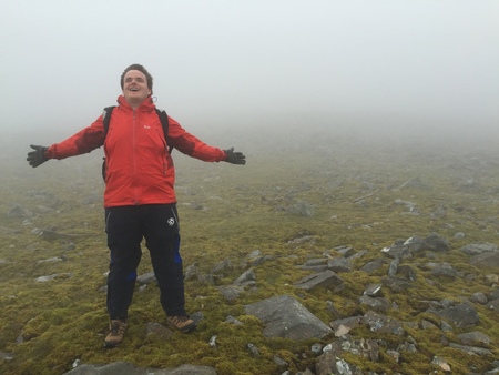
There are occasionally 'abbreviated cairns' with just one or two rocks on top of another, indicating the way. We eventually merge with the trail that was the continuation of the easiest route and head to the summit. After a short distance we are at the top. The top of England! Welcome to Scafell Pike, the highest peak in England.
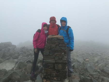
We three on the top of England!
After 20 minutes at the top we head down at 1:20pm. The plan is to take the easiest route all the way back down, we definitely don't want to climb back down the rock we climbed up on the ‘scenic’ option. After heading down off the summit, we head right. Initially what we thought was the trail was not, so we went further and found the route indicated by very large cairns.
After about 25 minutes or so, I am pretty sure we are not on the correct route because it would have had in view by now the valley we came up, and there wouldn't be a massive cliff on our left that is clearly not indicated by the topographical lines on our map. Although this is much more beautiful than the way we came up, it looks like we have been deceived in the clouds for where we began to come down. We are experiencing the strongest winds of the day with a steady fluctuation of 35-40 mph (56-64 km/h) with gusts reaching 45 mph (72 km/h). It isn't the most pleasant and is definitely blowing us off balance at times, so also not particularly safe.

Our unintended route.
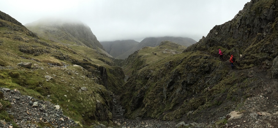
Our beautiful, unintended route.
Unfortunately we only have a map of our route and it doesn't show others or the topography of the rest of the mountain. We've seen people ahead of us and they came up the same way we did, so in our minds that really made us think we were on the intended route. We know at this point we don't want to go back up to find our intended route. The route we are on is way more beautiful than the one we came up. We can hitchhike or somehow find a taxi back to our vehicle, and the people ahead of us either also mistakenly have ended up on this route, or they planned it and have left vehicles at both trailheads, so maybe we can catch a ride back with them, if there is room for three more.
I catch up with them and they say this route ends back at the same place. We apparently headed right too soon and came down the back of the mountain, taking a route that is much longer.
Right where I have caught up to them is a section we have to climb down with our hands, I know Steve and Claire won't be super excited when they catch up.
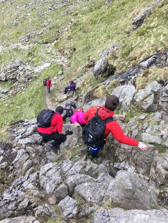
The down climb that nobody was super excited about.
As we descend further and further, the winds reduce more and more and it becomes more pleasant. Our route also merges with another route as we continue down through a valley with a river flowing down the middle.
Coming down a mountain on another route than you intended is pretty bad. Although with how beautiful it is, it has turned out to be the best mistake I have ever made in the outdoors. It ends up being better than our intended plan.

Merging trails and joining other hill walkers, who took even a different way down.
At 4:15pm we are back to where we started, and thankful we didn’t need to hitchhike to make it there.
And with the successful summit of Scafell Pike, that makes all four of the highest in each country of the United Kingdom! Northern Ireland: Slieve Donard, Wales: Snowdon, Scotland: Ben Nevis, England: Scafell Pike.
If you are in Seattle area and want to spend more time outdoors, consider becoming a member of The Mountaineers. They teach and lead more than climbing: I took their sailing course! Check out what they have to offer and then use promotional code ME15MTM and save $10 off your first year of membership.
Sunday, June 7, 2015
We go to church in the morning.
In the afternoon, Steve and I go on a countryside drive and end up at a section of Hadrian's Wall. The wall was built by the Romans starting in 122 AD, stretched 80 Roman Miles (73 miles / 117.5 km), and the purpose was perhaps to separate the Romans from the ‘barbarians.’

Remains of Hadrian’s Wall.

Remains of Hadrian’s Wall.
Photo Gallery – Hadrian’s Wall
Monday, June 8, 2015
At 1:05pm, I set off on my bike, with all my gear packed again into my pannier bags. After 2 miles (3.2 km) I am at the train station and after a short wait board the train with my bike. After two hours I depart the train in Manchester.
I bike 5 miles (8 km) to a pub near my friends’ home to wait until they are home from work.
Rovel finds me at the pub and it is the first time we have met in person. Caroline, who I met for lunch in Northern Ireland, married Rovel this past November. We head to their apartment and Caroline arrives home after not too long.
Tuesday, June 9, 2015
For dinner we go out to a restaurant. It doesn’t serve beer, but it is completely okay to go buy beer and bring it back to the restaurant. I have never heard of anywhere that would be okay in America!
Wednesday, June 10, 2015
In the afternoon, Caroline and I go to Lyme Park where we walk around seeing a handful of different sites and many Red Deer.
Thursday, June 11, 2015
At 1:45am, as I'm struggling to stay asleep, I hear air begin to hiss. Oh no, it's coming from the air mattress I’m sleeping on. I hear it on the side where my head is, which is also the side with the valve, and feel around in the dark to find the air. I can't. I put on my glasses and with the flashlight from my phone, try to find it. I still can't. The sound is quite a bit of air so after a while I find it strange that the mattress isn't going down at all. Then there also seems to be some other small noises from the window. What on earth? Then I realize it is my bike that is against that wall, and the air is coming from the tire, and the other small noises are the tire changing shape and the bike slowly moving against the wall. I watch the bike slowly lower itself as the rear tire loses all its air. That's crazy! The patch I installed one week ago, rode into England on, and just rode in Manchester on, just now decides to come loose.
I leave Manchester on my bike just after 2:00pm. I am primarily on National Cycling Network Route 62, which definitely doesn't have road bikes in mind. The route is primarily on fine gravel paths and dirt trails with a large portion along the Manchester Ship Canal. The dirt portion I am used to, except for the fact that they have a new gate type for me here!

The wonderful gates on the route.
You cannot be sitting on your seat and pass through. I have to unclip my shoes, have my butt below the seat height, crouch down, and 'waddle' through. I assume they are for horses and these same trails do have horse signs. There are over 20 sets of these gates so I am continually stopping and starting again. And the efficiency loss of riding on gravel and dirt isn't making my pace happy either.
I come to a point where the signs on the trail indicating NCN 62, don't agree with where Google Maps has it labeled. It is hard to decide which route to take, because the route per Google Maps actually seems nicer.
But then later, Google Maps has me leave the canal trail and go through a narrow pathway between barbwire fences in an industrial area. The path was not much wider than needed for my bike, was overgrown with vegetation, and had several turns that wouldn't be possible while riding. How does Google even know about this?
I arrive into Liverpool just after 5:00pm, having cycled 37 miles (59 km) at a pace of 12.2 mph (19.6 km/h) without taking any breaks. It is faster than I thought I was doing with the terrain and all those gates! Today has been very sunny, I'm keeping my 'Scottish tan' fresh.
I take the train back to Manchester.
Friday, June 12, 2015
For dinner we go to a restaurant called Pie, where they serve meat pies.
Saturday, June 13, 2015
At 2:35pm, we leave the apartment, Caroline driving me to the airport.