I’m cycling in raising funds for childhood cancer research.
Did you know: two-thirds of kids who survive a cancer diagnosis go on to face life-long, debilitating side effects from treatment.
Ben Towne Foundation supports groundbreaking research at the Ben Towne Center for Childhood Cancer Research. The focus of the BTCCCR is to discover and develop innovative, targeted therapies for curing childhood cancers - with the goal of reducing or eliminating the need for surgery, chemotherapy, and radiation treatments.
Check out The Mighty T, an animated short film that illustrates the process of reprogramming the body's infection-fighting T cells to seek out and destroy cancer cells wherever they are hiding in the body:
Thank you so much to those that have donated. We are ready for some more! Please consider donating by clicking on the logo below.

Wednesday, May 20, 2015
I slept in. I don’t feel sore from cycling, which I am a little shocked about, but I guess not pushing your hardest does that.
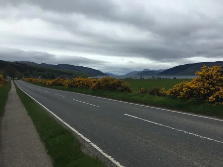
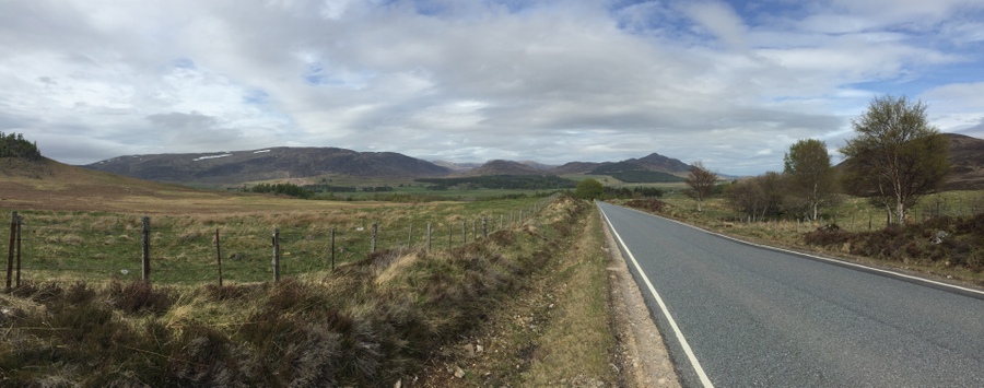
Just after noon, I leave in a short sleeve cycling jersey and cycling shorts on National Cycling Route 1. From Evanton, I ride 6.6 miles (10.6 km) south to Tulloch Castle in Dingwall.

Cycling route between Evanton to Dingwall.
The castle is now a hotel but people are welcome to come in and walk throughout the common spaces. The place was very quiet and one of the staff offered to give me a tour of the place, which included the dungeon and the lookout tower.
From Tulloch Castle, I headed just 1.4 miles (2.3 km) south to the location of where Dingwall Castle once stood. This castle is really why I stopped at Tulloch Castle, because I knew they would be able to tell me where it once stood. There is a small tower that still exists but it is not original. History says it was rebuilt from remains about 1825, after the castle was leveled in 1818. What has brought me here is the connection to Clan Mackay. In 1370, a chief of Clan Mackay was murdered here, along with his son, as they slept in the night. They were murdered by a Sutherland, a member of the clan they later battled in 1433 in Tongue. The reason why I was sure that staff at Tulloch Castle would know the location of Dingwall Castle is because legend has it that a tunnel connected them. Although it has never been verified, there are two entries at Tulloch that make no sense other than they are to a tunnel that went in that direction, since the entries are in alignment to head that way.
From the rebuilt castle remains, I go a short distance to the museum in Dingwall. I am now noticing my muscles are quite tired from yesterday even though they're not sore. The museum has an oak panel that is the only known item remaining from the interior of Dingwall Castle.
There was also a very old bicycle called a velocipede, which I am entirely thankful is not what I am riding.

The velocipede I am glad to not be riding.
I leave the museum and head south. When I reach the River Beauly, I cross over the Kessock Bridge and enter Inverness. I entered the city traffic and movement became quite slow. At 6:00pm, after cycling 14.9 miles (24.0 km) from Dingwall, I arrive at my hostel for the night where I booked a private room.

The Kessock Bridge across the River Beauly to reach Inverness.
The hostel didn’t serve dinner unless you pre-booked it, so I went to an Irish Pub not far away and had fish n chips.
Photo Gallery – Evanton to Inverness: Cycling Day 10
Daily cycling stats:
Distance: 22.9 miles (36.9 km)
Moving average: 7.68 mph (12.35 km/h)
Thursday, May 21, 2015
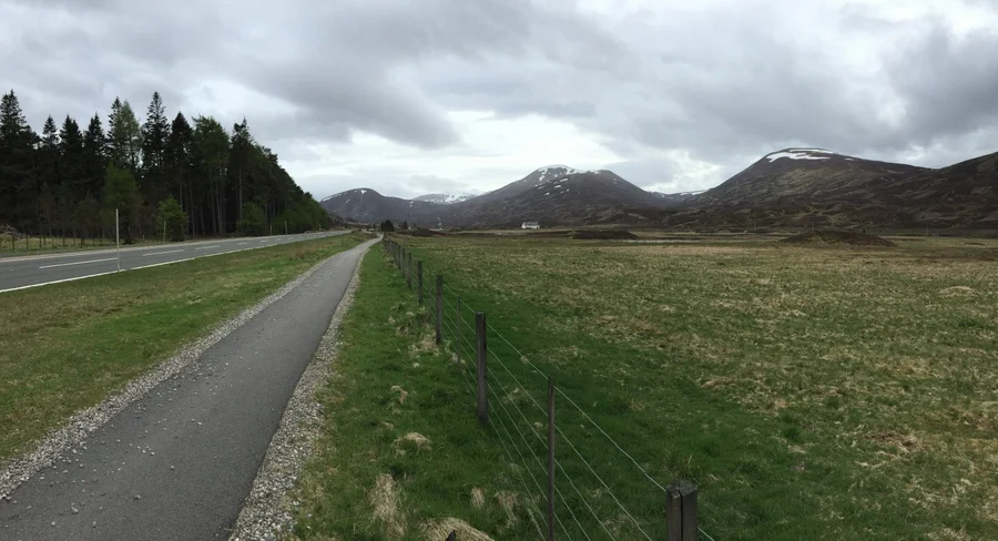
Shortly after leaving town, my route is on National Cycling Route 78. I pass through Dores 9.5 miles (15.3 km) after leaving Inverness, having cycled a pace of 8.64 mph (13.90 km/h). Dores is located on the east side of Loch Ness. There have been low winds of 5-10 mph (8-16 km/h).
Cycling route between Inverness and Dores.
After leaving Dores, the route stays parallel to Loch Ness as I head south, with occasional views of it through the trees. After 8.0 miles (12.9 km) I pass through Inverfarigaig, having cycled a pace of 9.60 mph (15.45 km/h). There have been a little bit heavier winds, about 15 mph (24 km/h).

Cycling route between Dores to Inverfarigaig.
From Inverfarigaig, I cycle south, passing through Foyers and Whitebridge and oh there are some hills. And I love hills. Sometimes I am like, "Hill, I love you!" I’ve climbed 1,250 feet (381 meters) in elevation and now it is time to come down. I go down the steepest hill I have ever cycled down, exceeding 45 mph (72 km/h) and having to brake to stay in my lane, which was honestly scary going through some turns. But it made all the uphill worth it!
Coming down the hill puts me into Fort Augustus, situated on the south end of Loch Ness. Since Inverfarigaig, I have cycled 15.6 miles (25.1 km) at a pace of 7.09 mph (11.41 km/h).
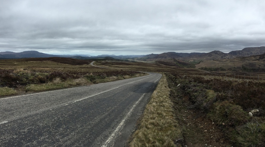
Cycling route between Inverfarigaig to Fort Augustus.
I take a break in Fort Augustus at a restaurant, and then check out the locks that are on the south side of Loch Ness, connecting it to the adjacent waterway. I leave Fort August, thinking my turn was further away then it really ended up being. So after cruising down a hill and clearly having missed my turn, I cycle back up the hill to Fort Augustus and find that my route is right by the locks, parallel to the waterway south of Loch Ness. Wow, that did not feel smart!
I head south on the trail parallel to the waterway, now being on a gravel trail that is the Great Glen Way. Cycling on gravel is not lovely. I did not read anything about gravel, but I didn't actually read much, just looked at maps, I’ll admit that. One nice thing about cycling along the waterway and lochs is that you know it is going to be flat.

Cycling route after leaving Fort Augustus.
I am cycling along and see a canoe heading toward me from the opposite direction. They signal for my attention and ask if I have an air pump. I think, for what? When they take their canoe out of the water, they have a two-wheel carrier that goes under the canoe at one end, making it possible to wheel on land with their gear still inside. One of the wheels is flat. They use the carrier to move the canoe when out of the water not only at the end of the day but also to go around the locks, since it is much faster than waiting to go through them with opening, closing, and the water level changing before continuing on.
I am so far behind schedule, but I’m probably the only one they are going to see that has an air pump and can help them: a cyclist. Neither of us ever imagined the other would need help from the other. The tire ends up having a leak so we remove it and use one of my patches to fix it. After more than 30 minutes, they are on their way again and I am on mine.
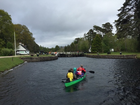
The folks I helped now heading off.
Not long after leaving, there starts to be a mist. My new policy is to give light rain some time to see if it picks up or stops soon. And I'm quite warm already. Putting on my waterproof jacket is only going to make me sweat more than the mist is making me wet. And it's not cold at all.
The route continues on gravel mile after mile, but a lot of it is on a path through the trees. And I do like it compared to the wind! The mist continues. I pass by the Cullochy Lock and the mist mists on. At 5:22pm, I arrive at the Aberchalder Swing Bridge, since Fort Augustus only having cycled 4.4 miles (7.1 km) at a pace of 6.60 mph (10.62 km/h).
View from the swing bridge in Aberchalder.
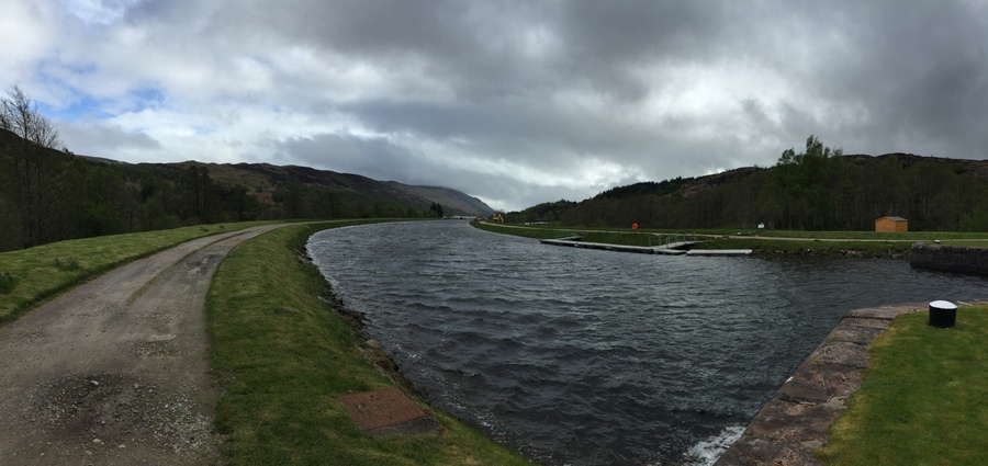
After leaving the swing bridge, I am now cycling along Loch Oich. I have been cycling along the Caledonian Canal, which is a combination of natural lakes and manmade canals connecting them. It cuts across the highlands connecting the oceans on either side. ‘Loch’ simply means lake and on the canal there are also locks, used to raise and lower boats.
Soon the gravel transitions to a trail with dirt and mud. It is in the trees so there is no wind. Despite how much slower the ride is compared to riding on pavement, I'll take this over the wind. I actually feel I am accomplishing distance.
The trail I was really not anticipating taking my road bike on.
The mist continues. But I decided that I am not changing clothing.
I cruise through the woods and the needles and dead leaves off the trees make a beautiful layer of cushion on the dirt and a very smooth ride. I am riding my road bike like a mountain bike now, as much as one can with pannier bags. There is a low branch that I duck under. When I come out on the other side, I almost go over a dead sheep. Ugh!

The dirt trail continues.
The woods and dirt trail transition back to gravel. It is actually onto a new trail that has recently been constructed. It is gravel but has been freshly compacted. Riding on it is nice, nearly as smooth and fast as pavement.
I am back out of the trees and pass by Laggan Locks, with winds now 15-20 mph (24-32 km/h). After the locks, I am now cycling along Loch Lochy.

Cycling through mist along the Caledonian Canal.
I come upon a section of the new trail that is currently under construction, literally. The equipment drivers stop and I walk my bike around. Soon after that, I leave the Great Glen Way trail and continue on the highway. The mist becomes heavier and my shirt and gloves become damper, but I’m still not feeling cold.
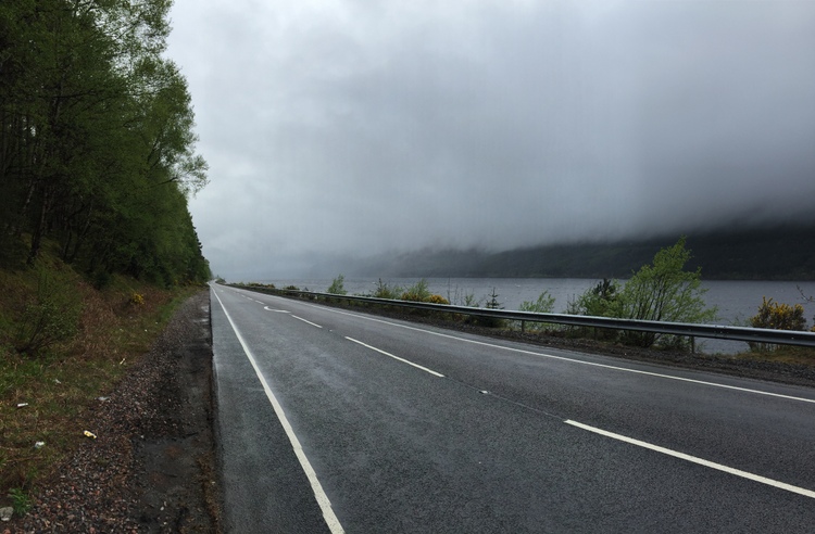
Cycling along the highway with the mist over the loch.
Somewhere before now, my route was supposed to leave the road again but with the rain how it is, I'm not interested in encountering any mud! So I stay on the road because it is more certain.
I come upon a long section of uphill road that is under construction. There is a temporary traffic signal set up since one direction is closed. I wait for the light to be green and start cycling. I am not through the area when the traffic from the other way has already started coming! My headlight is flashing bright and clearly I can be seen. But the front driver is not slowing down at all and he isn’t giving any space for me when he could be. I have nowhere to go! The temporary traffic signal lights don’t allow enough time for a cyclist going uphill. I have to unclip my shoes and go tight into the guardrail, with his side mirror barely missing me. Then he yells out his window at me like I was in the wrong. What an (expletive)!
Not far after the construction zone, there is a paved area on the side of the road to pull off. After taking a short break, because I’m on a massive hill, I go to start again. When I first put my right foot down to clip into the pedal, unintentionally my momentum goes that way and I fall over while at a stand still. My bike is on top of my right leg, with my foot clipped in, and I’m laying on the pavement with the water from the rain running by me. Fun one.
I’m up. I’m sore. Onward.
At 9:00pm, I arrive at my hostel for the night, substantially past when I would have liked to arrive. Since the Aberchalder Swing Bridge, I have cycled 27.5 miles (44.3 km) at a pace of 7.78 mph (12.53 km/h).
Outside, standing in the rain, is a girl holding two bikes, so it appears her and a friend have just arrived. I ask, "Did you just arrive?" "Yes." "Where did you start?" "Inverness." "Me too." "When did you start?" "This morning. I assumed you meant you started there this morning as well." "No, we've taken three days. I didn't think it was possible to do in one day." Well it is, but it takes until 9:00pm.
Photo Gallery – Inverness to Fort William: Cycling Day 11
With it being 9:00pm, I have arrived too late for dinner at the hostel. So I head down the road in the rain for about a quarter mile to a restaurant.
I have mixed thoughts about today. In reality, what I cycled would be much more distance in the equivalent to what would be my normal cycling conditions at home; not in the mountains, not in the wind, not in the rain, not on gravel, not on dirt and mud, not with pannier bags. But I've not been thinking that way for some reason. I just completed 65.0 miles (104.6 km) of the best (worst) cycling that Scotland has to offer. Mile by mile, revolution by revolution, gearshift by gearshift, I know what I've been cycling for. And I'm exhausted.
We'll see how my muscles feel in the morning.
When I leave the restaurant at 10:45pm, it is raining still, a little harder now. Once back at the hostel, I take my pannier bags to the dorm room. I then head back outside to my bike and remove my lights and such before putting it in the cycle storage shed. Then I hang some items in the drying room inside, take a shower, and am to bed at midnight.
Daily cycling stats:
Distance: 65.0 miles (104.6 km)
Moving average: 7.80 mph (12.55 km/h)
Friday, May 22, 2015
Today is a rest day from cycling. I do not want to wake up this morning. Yep, I’m sore. It is mainly my knees, more so the left than the right.
After breakfast, I leave the hostel on foot just before 10:00am and head to the visitor centre down the road. After learning of the conditions and weather forecast for different altitudes, I am starting at the trailhead at 10:21am.
The view at 11:03am.

The view at 12:18pm.

The view at 12:24pm.
At 12:28pm, I come upon a stream. Normally for something of this size, I would determine a path on the rocks to walk across even if my boots became a little wet on the outside. But I’m not wearing boots, instead I’m in low heel hiking shoes, and it wouldn’t take much water to come in over the top. So I play it safe and take off my shoes and socks and walk across barefoot.

The view at 12:48pm.

The view at 12:58pm.
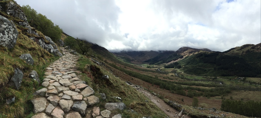
Shortly after many incredible views, it becomes quite foggy, and then the trail becomes covered with snow.
At 2:28pm, I reach the top of the mountain Ben Nevis. I was at the top for just 15 minutes before heading down because it was cold and as the top was in the clouds, there was no view to enjoy from up there, but there would be by heading back down.
There hadn’t been much wind during the ascent, but the wind picks up a little bit after leaving the top. The moisture from the clouds builds up on my jacket and pants.
By 3:25pm, I am off the snow and 30 minutes after that the fog has thinned enough to see down again to the valley and beyond that to the Caledonian Canal. It is wondrous to have seen it from the very edge as I cycled along it to now seeing it from above.
As I continue down, everything with the climate improves. I change to thinner gloves, then later remove those gloves and my beanie, followed by unzipping both jackets for ventilation.
At 4:20pm, I am back at the stream. I contemplate the stream and the rocks for some five minutes, going back and forth on my decision. I go for it and make it across without my shoes becoming wet. It was also an easier decision since I was going down to better weather, rather than up into the snow, where my wet feet would have froze.
At 5:00pm, I remove my jacket and waterproof pants and 25 minutes later am down to just a t-shirt. The afternoon could not be nicer, with the sun out in full force. Another 30 minutes and I am at the trailhead by the hostel.
Saturday, May 23, 2015
Before departing the hostel, I take a lot of time and clean my chain. It is disgusting from all the terrain I cycled on coming here, so much of it being gravel and dirt, and that has all accumulated in my chain.
By 10:47am, I am on the way, starting the day in my short sleeve jersey and leg warmers. After being a ways out of town, and trying to find the route I want to be on, I took an unintended detour and by the time I was where I wanted to be, that had taken me about 20 minutes. I’m not very happy.
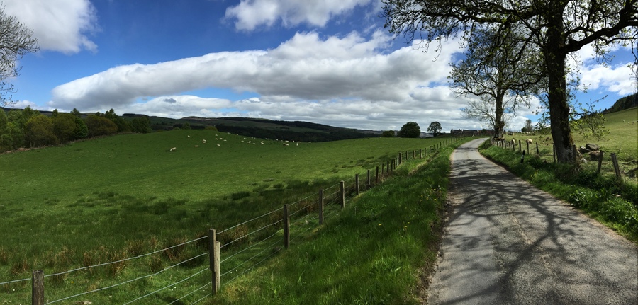
At 12:12pm, I pass through Spean Bridge, having cycled 13.8 miles (22.2 km) from the hostel at a pace of 9.74 mph (15.68 km/h). I’m still in a short sleeve jersey and the winds have been low.
I arrive at Laggan Dam on the River Spean at 1:30pm, having cycled 9.6 miles (15.4 km) since Spean Bridge at a pace of 10.11 mph (16.26 km/h). I have noticed that I have been cycling hill grades in 2nd gear that I previously would have been cycling in 1st gear, I don't know how this is happening, but it feels good.

Cycling route between Spean Bridge and Laggan Dam.

The River Spean and the Laggan Dam.
From the dam, I cycle along Loch Laggan until I reach Cairngorms National Park at 2:30pm, having cycled 12.1 miles (19.5 km/h) at a pace of 15.13 mph (24.34 km/h), which I am very excited about. Before I enter the national park, I take a break and eat lunch.
After cycling 6.2 miles (10.0 km) since entering the national park, I take a turn onto a different highway, having rode at a pace of 10.94 mph (17.61 km/h).
The cycling route in Cairngorms National Park.
It became a little windy after that turn, with wind speeds of 10-15 mph (16-24 km/h). I pass through Dalwhinnie and then the winds pick up more.
Cycling route on the way to Dalwhinnie.
By the time I am through Dalwhinnie, I am now on National Cycling Route 7, which is located in a valley between the highway and train tracks. I’ve cycled strong all day and now this wind is taking a toll, so I just cycle in low gear for the last few miles until I arrive at the B&B just after 5:00pm, way earlier than I expected it would take. From the major turn before Dalwhinnie, I have cycled 11.1 miles (17.9 km) at a pace 6.34 mph (10.21 km/h). That wind really slowed me down!
The last miles before arriving at my B&B, which is the white building in the photo.
I can’t believe that I have been in a short sleeve jersey all day and did not have a single clothing addition or subtraction due to weather. I even have a tan line!
Photo Gallery – Fort William to Dalwhinnie: Cycling Day 12
The B&B is located in a beautiful valley, the one I was cycling in since Dalwhinnie, and there is not another building within sight. The inside of the place is so nice. As I am going up the stairs to my room, my calves are letting me know how they feel. As I’m nearing the top of the stairs, from below a man says, "Are you from Washington?" I'm wondering why on earth he would think to ask that when half a second later I realize I am wearing a University of Washington purple and gold cycling jersey. "And where are you from?" From Texas.
After taking a nap, I go downstairs for dinner and eat with the family from Texas. Afterward, we play cards until going to bed. It was so nice to have some people to interact with for an extended period of time. It’s been getting a little lonely the last few days!
Daily cycling stats:
Distance: 52.8 miles (85.0 km)
Moving average: 9.63 mph (15.50 km/h)
Sunday, May 24, 2015
I wake at 8:00am. There is rain coming down on the skylight above. My calves are sore as I go downstairs to breakfast, which I eat with the Texans.
Yesterday, I started at an elevation of 43 feet (10 meters) and ended at 1,394 feet (425 meters). Today I ride downhill.
The rain has stopped by the time I leave the B&B, but it lightly starts again shortly after. I am continuing on National Cycling Route 7 as I start the day. I start at a slow pace to warm up, as my muscles need it.
I arrive into Calvine, having cycled 16.1 miles (25.9 km) at a pace of 13.80 mph (22.21 km/h) since leaving the B&B. I take a brief stop, during which it starts raining a good amount. I put on my raingear and continue on.
In Killicrankie, I make a stop, having cycled 8.2 miles (13.2 km) since Calvine, at a pace of 14.47 mph (23.29 km/h). I ate, cleaned my chain, and left now wearing my windbreaker.
There are plenty of sheep and cows around today. I pass through Pitlochry, just 4.0 miles (6.4 km) since Killicrankie, having cycled at a pace of 12.00 mph (19.31 km/h). Just after Pitlochry, I take a break because I seemed to have missed a turn, as I come to the motorway that is definitely not my route. It is now sunny out, so I drop the windbreaker and pants and then head back.
In town, there are no signs for the cycling route where I need to make my turn. I see some other cyclists and they send me in the right direction. After a short distance, I dismount and walk across a pedestrian suspension bridge. From here National Cycling Route 7 transitions to Route 77 for my journey south.
The cycling route after Pitlochry.
After cycling 11.3 miles (18.2 km) at pace of 8.58 mph (13.81 km/h) from Pitlochry, I intersect with the motorway. The signs are extremely confusing. The motorway sign disagrees with the cycling route sign and two walking path signs conflict with each other. So confused. All I can guess is that somewhere ahead the path must take a U-turn to go down and cross under the motorway and then head back in the opposite direction. And I discover that is exactly what it does. From there I am cycling along the River Tay.

The cycling route before reaching the motorway.
After cycling another 7.7 miles (12.4 km) at a pace of 9.24 mph (14.87 km/h), I arrive into Bankfoot.

The cycling route after Bankfoot.
I continue on, the route rejoining the River Tay, after it had left it some time ago. The path is dirt with light amounts of gravel at times. Then the path becomes paved and the route feels like the Burke Gilman in Seattle along the slough (except for this river is much nicer and flowing). Soon I pass through a golf course and enter Perth at 5:55pm, having cycled 9.6 miles (15.4 km) at a pace of 7.68 mph (12.36 km/h) since leaving Bankfoot. It takes a few more minutes to navigate the one-way streets to my hotel.

Cycling route on the way to Perth.
Photo Gallery – Dalwhinnie to Perth: Cycling Day 13
I would generally avoid large hotels in a city due to cost, but this ended up being the best deal. They had a Sunday night promotion that was discounted plus included dinner and breakfast so I booked it! They have me store my bike in the cloakroom, which I just found to be hilarious and enjoyed it being in there. My room is on the third floor, being the second farthest room away from reception that the place has to offer. My calves did not like those stairs. I do have a more defined tan line on my arms.
I really can't believe I am doing this. That I am here. That I've cycled as far as I have, and I have more to go. I've cycled more than I would ever have imagined doing, and there is more ahead. And I'm excited for it. Every. Remaining. Mile.
Daily cycling stats:
Distance: 56.9 miles (91.6 km)
Moving average: 10.41 mph (16.75 km/h)
Accumulative cycling stats:
Distance: 482.7 miles (772.2 km)
Moving average: 8.07 mph (12.91 km/h)
Alright, I think you are getting good and ready to donate to Ben Towne Foundation. Will you donate?

Map of cycling in the highlands:

"You are never too old to set another goal or to dream a new dream." – C. S. Lewis
Novelist, broadcaster, apologist. (November 29, 1898 – November 22, 1963)